Whitley Village
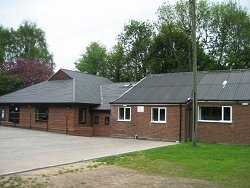
Our meetings are held in the Village Hall in Whitley, Cheshire. Whitley is just off the A49, ten minutes from Junction 10 of the M56. The Village Hall is on the east side of Village Lane.
If you are using your Sat Nav to get to the hall use the post code WA4 4EJ.
Whitley is made up of Higher Whitley to the North and East and Lower Whitley to the South and West. Higher Whitley includes a separate small residential area of Norcott Brook. Key social hubs in Lower Whitley include the Chetwode Arms, St. Lukes Church and the Village Hall in Higher Whitley, as well as the village school and the Birch & Bottle. The focal point of the village is a medium sized pond known as ‘Town Pit’, now registered as a village green.
